Loading courses…
Frankfort, KY
Lakeview Springs Golf
View the hole-by-hole scorecard and tee yardages. Fly through Lakeview Springs Golf hole by hole in 3D to explore the mapped holes before you play. Explore the interactive course map. Download a free printable course map PDF and a free printable yardage book PDF. No signup required.
9 holes29 parmunicipal3 tee options
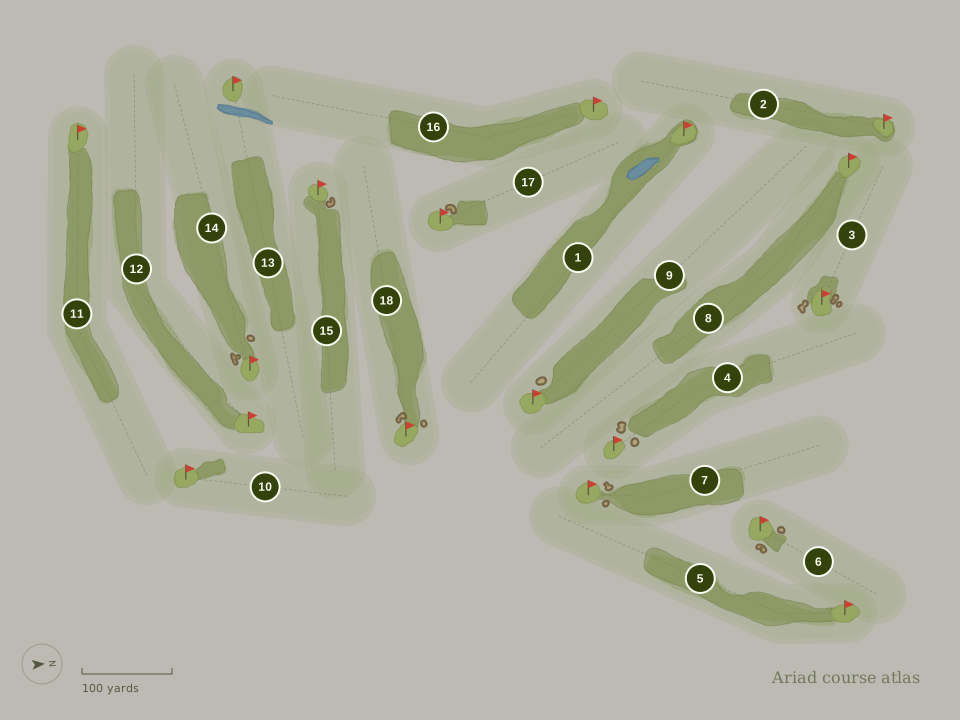
Lakeview Springs Golf course layout, yardage book, scorecard, green maps
Interactive course map
Download PDFExplore all 9 holes at Lakeview Springs Golf. Select a hole to see its details. Free printable PDF · No signup required.

FairwayGreenBunkerWater
HOLE 1
Hole 1Par 4
225 yards · Red WomenHandicap 8
- Red Women
- 225 yd
- Blue Men
- 225 yd
- White Men
- 213 yd
Yardage book & Green maps
Download PDFExplore 9 mapped hole layouts with tee-to-green distances in the free yardage book. View 9 green maps showing putting surface outlines and dimensions where available. No signup required.
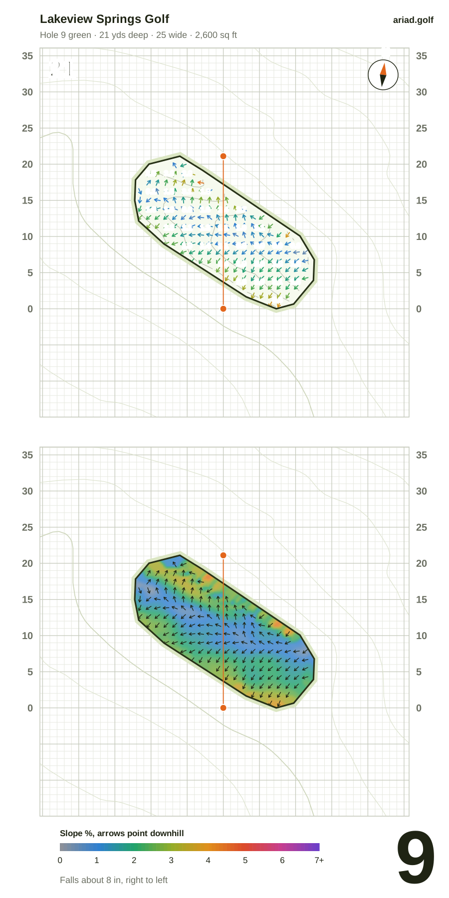
Par 4 · 225 yds (Red) · Handicap 8
- Green
- 23 yds deep, 15 wide · 2,700 sq ft
- Shape
- Straight
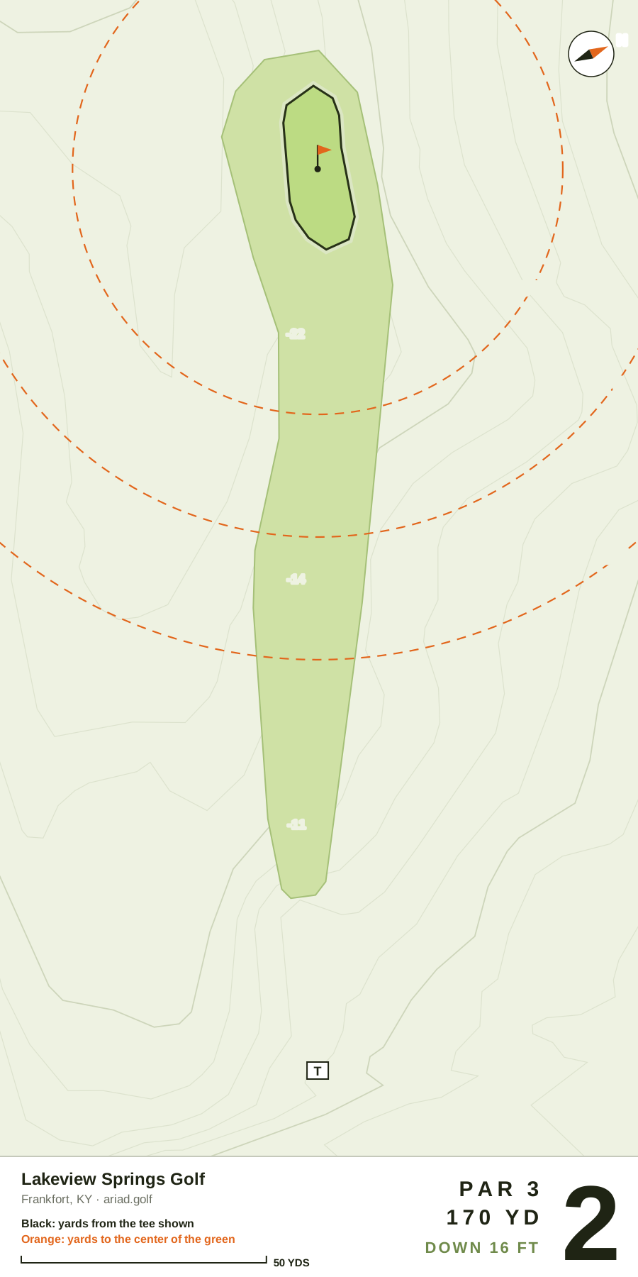
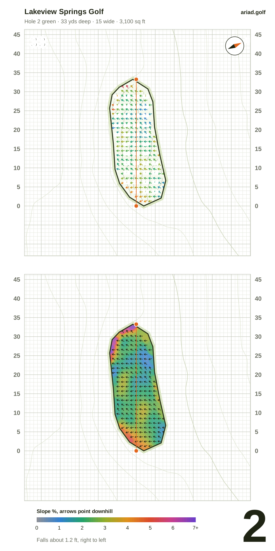
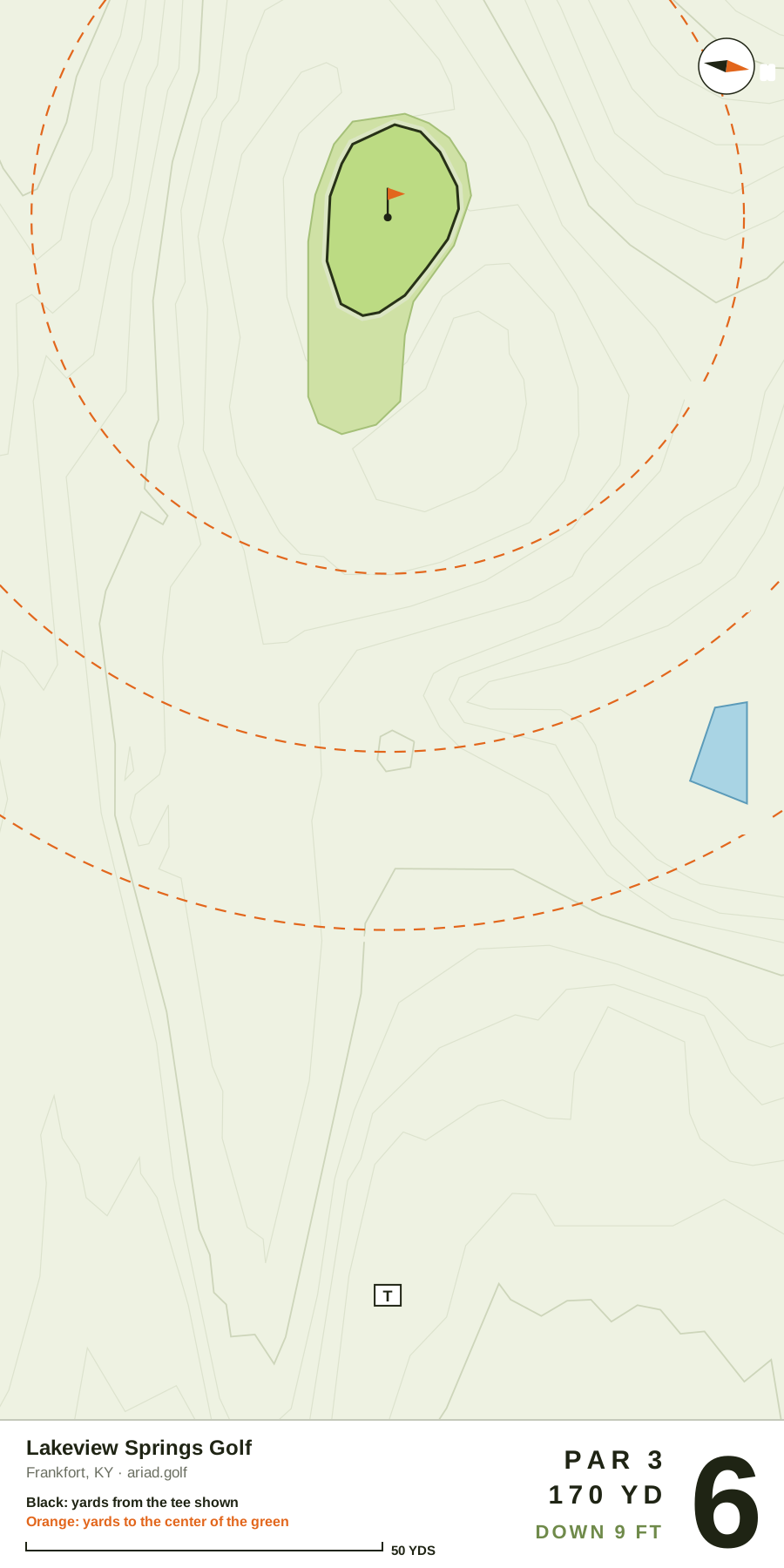
Par 3 · 170 yds (Red) · Handicap 2
- Green
- 33 yds deep, 15 wide · 3,100 sq ft
- Shape
- Straight
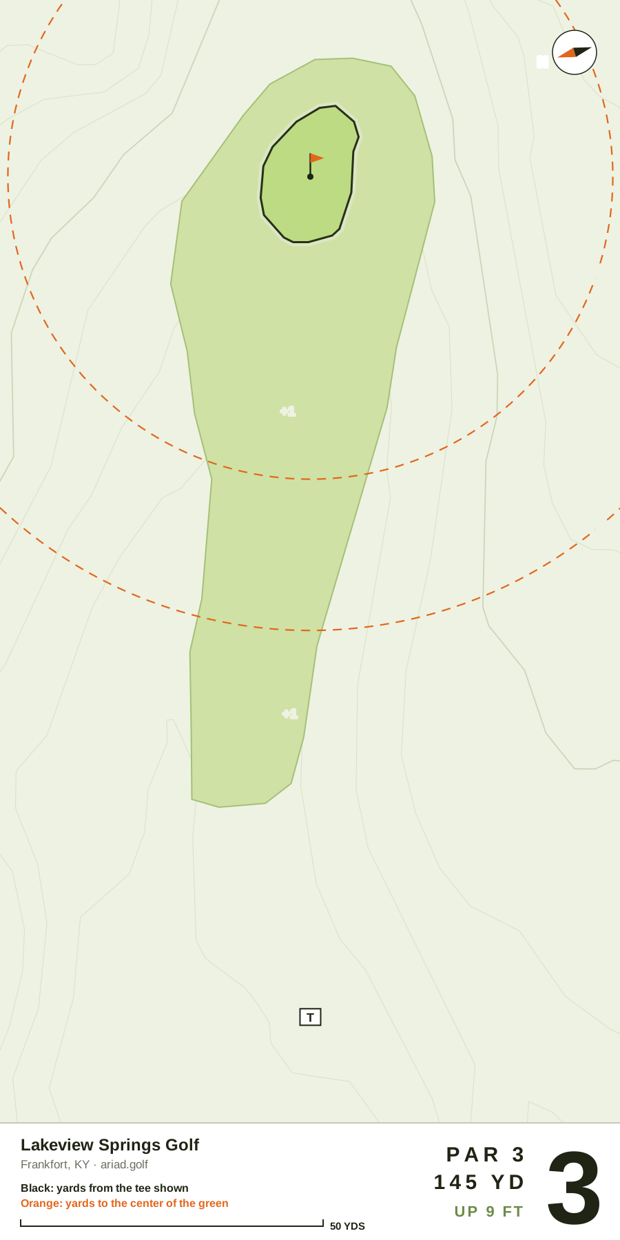
Par 3 · 145 yds (Red) · Handicap 9
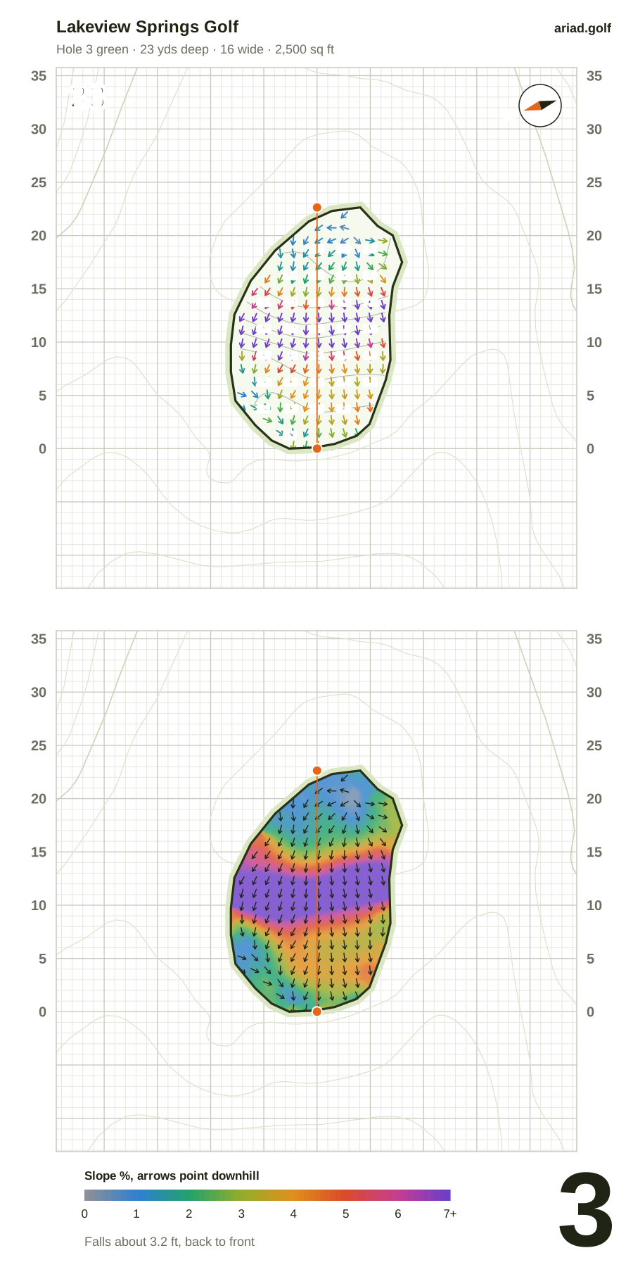
- Green
- 23 yds deep, 16 wide · 2,500 sq ft
- Shape
- Straight
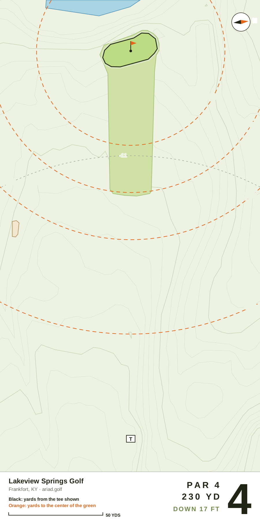
Par 4 · 230 yds (Red) · Handicap 4
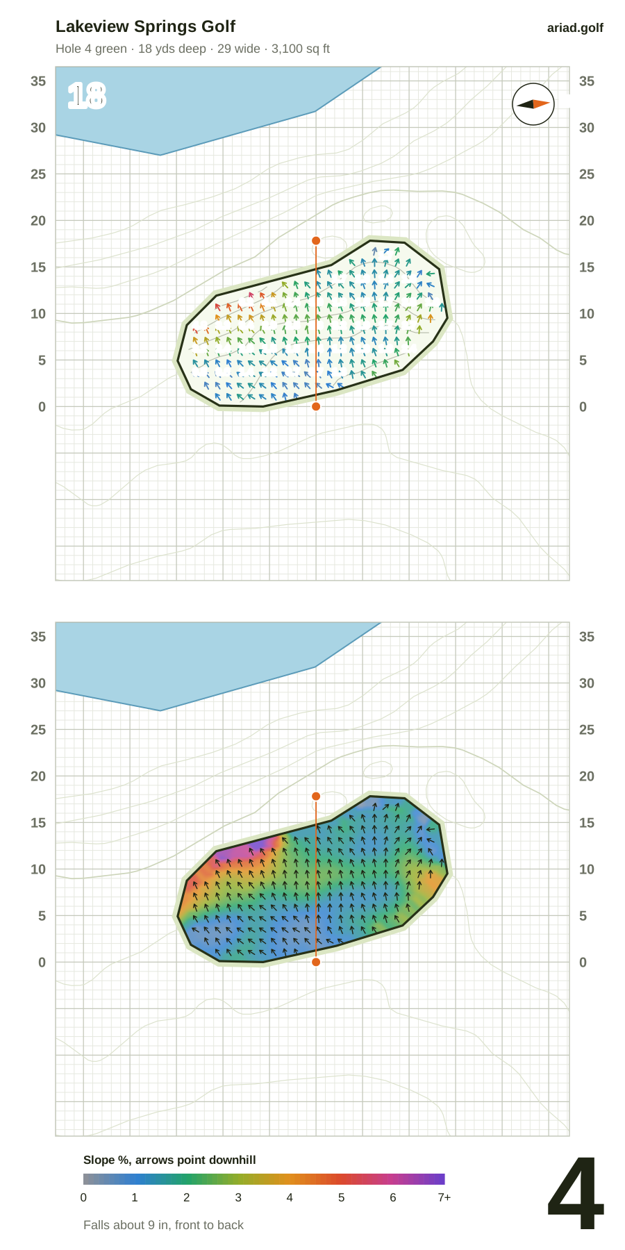
- Green
- 18 yds deep, 29 wide · 3,100 sq ft
- Shape
- Straight
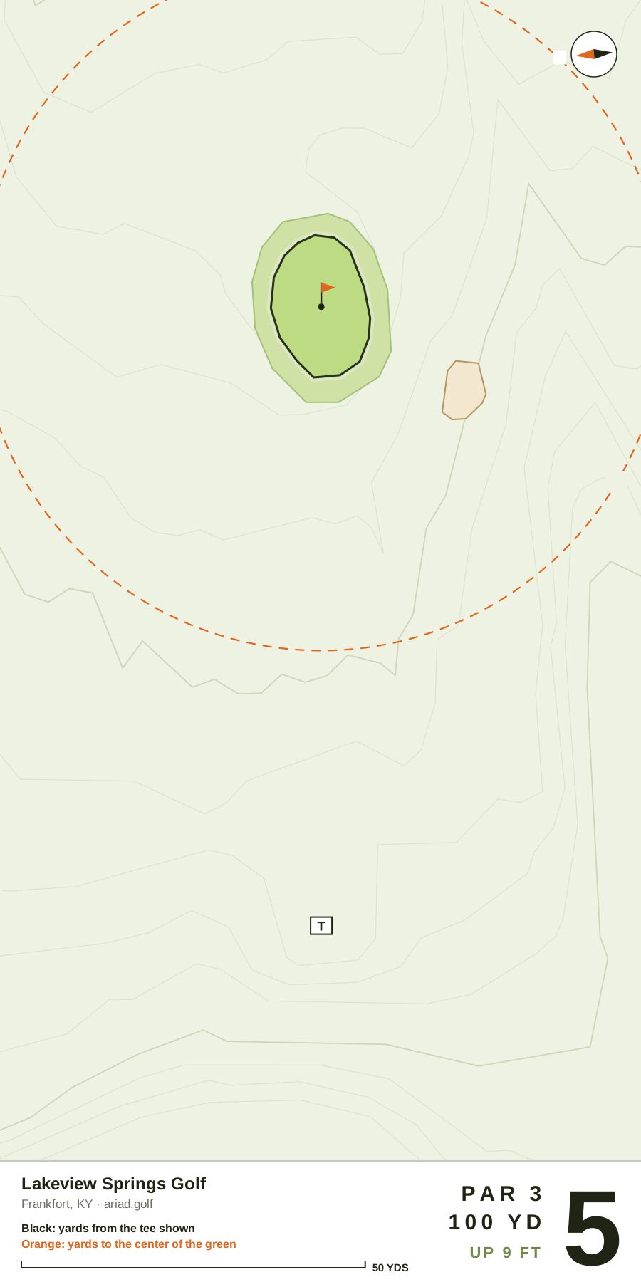
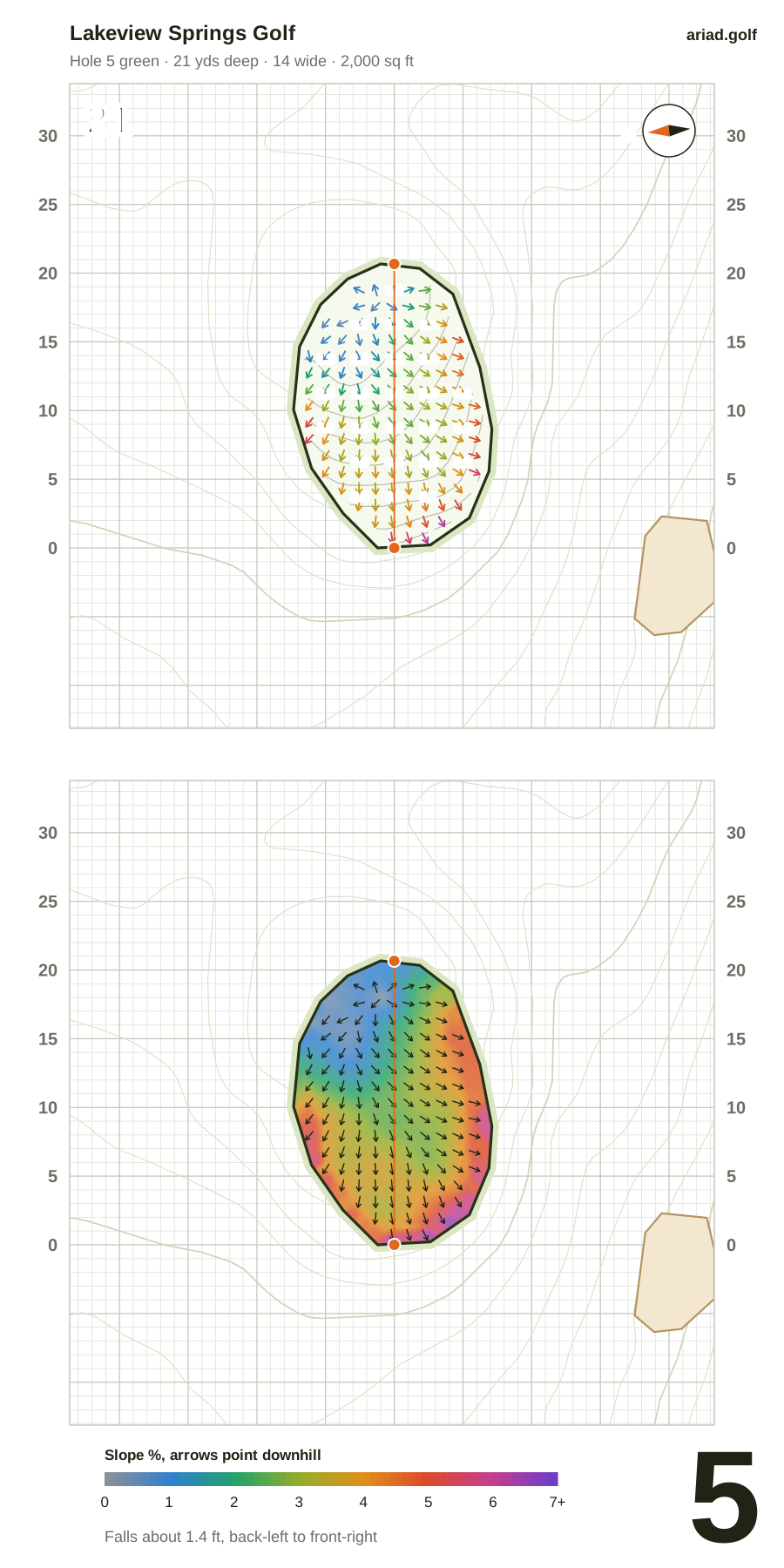
Par 3 · 100 yds (Red) · Handicap 5
- Green
- 21 yds deep, 14 wide · 2,000 sq ft
- Shape
- Straight
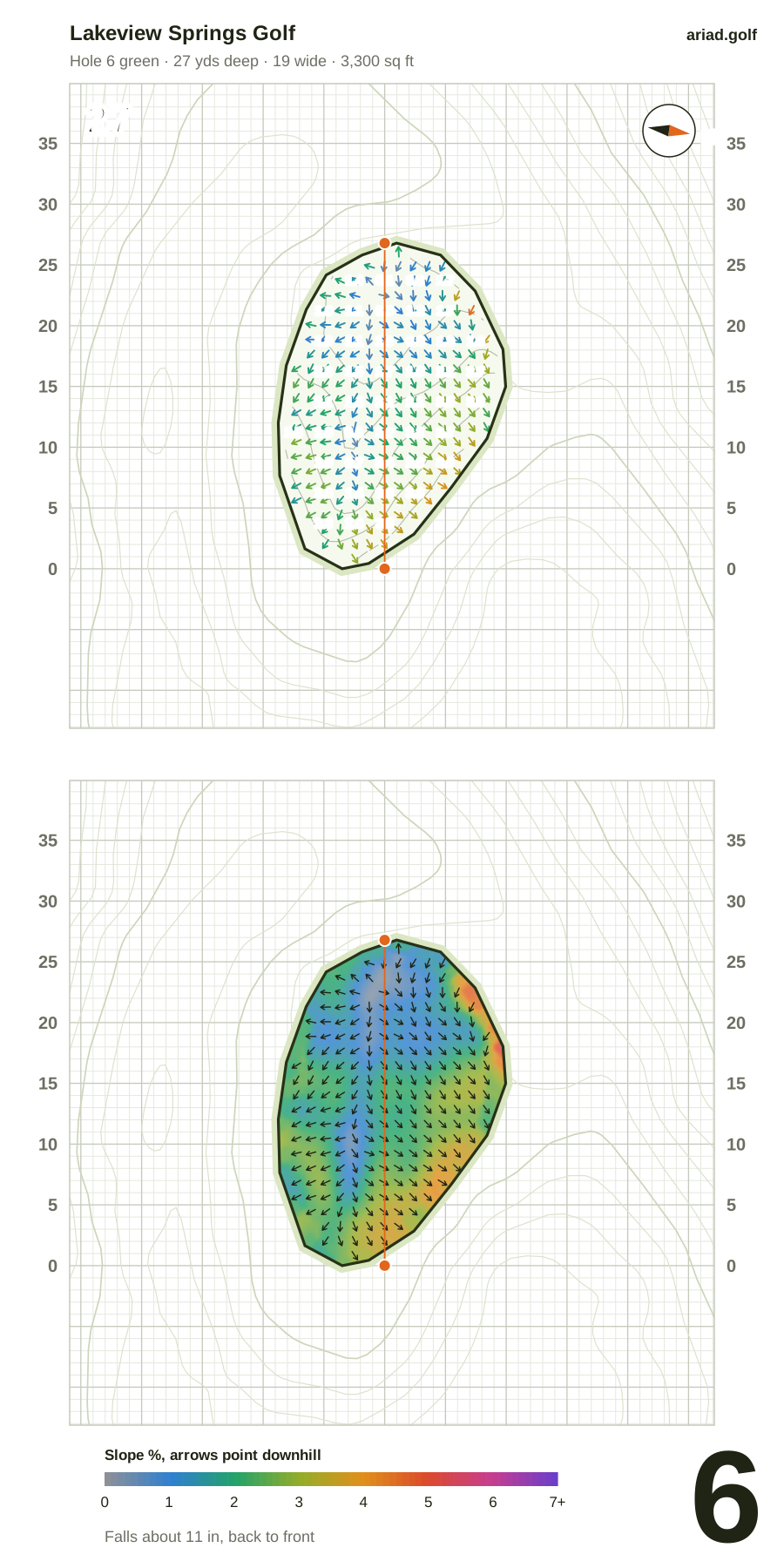
Par 3 · 170 yds (Red) · Handicap 3
- Green
- 27 yds deep, 19 wide · 3,300 sq ft
- Shape
- Straight
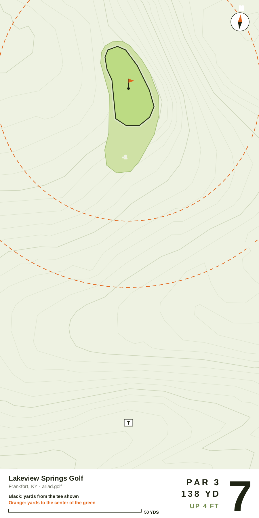
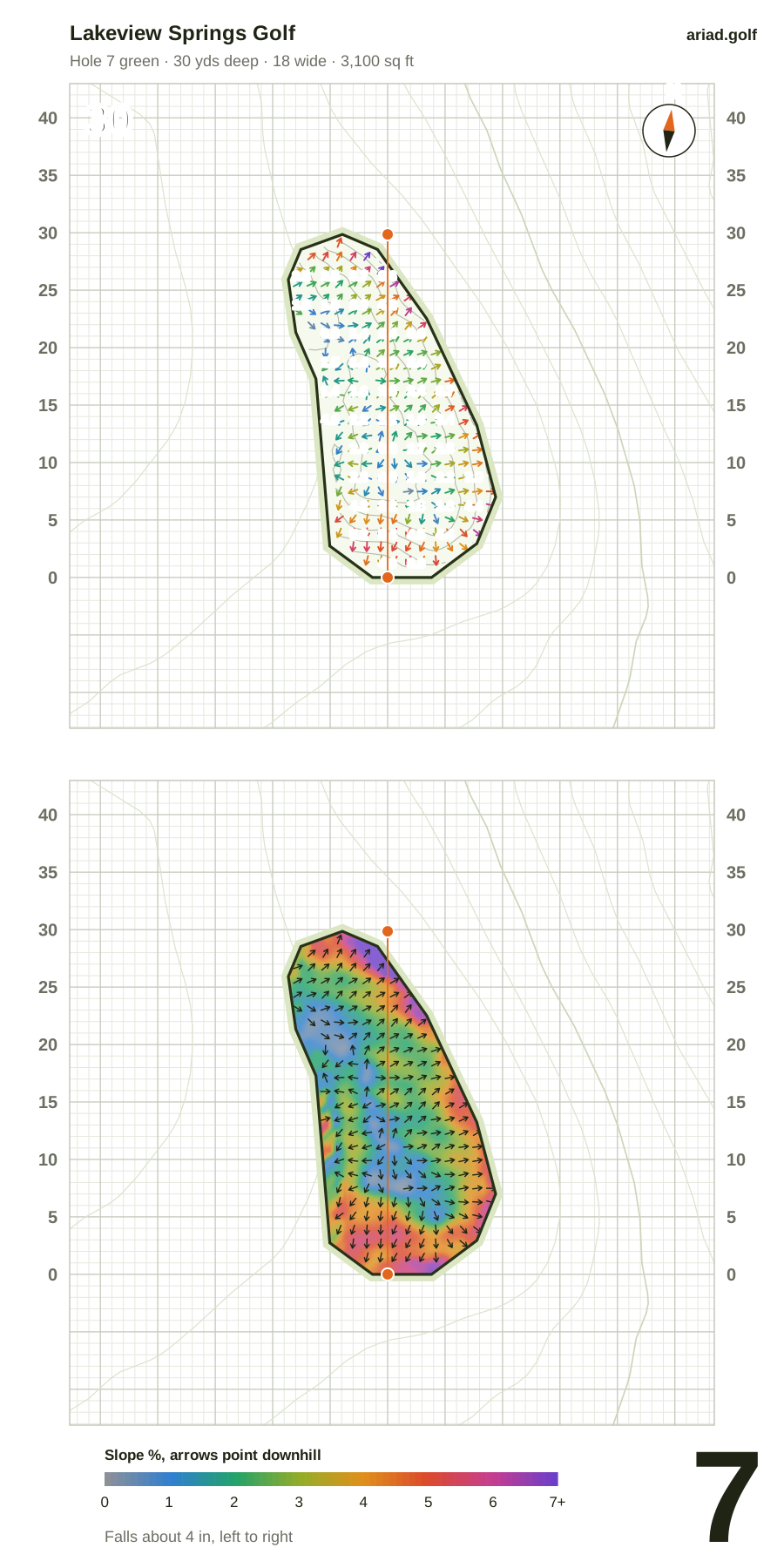
Par 3 · 138 yds (Red) · Handicap 6
- Green
- 30 yds deep, 18 wide · 3,100 sq ft
- Shape
- Straight
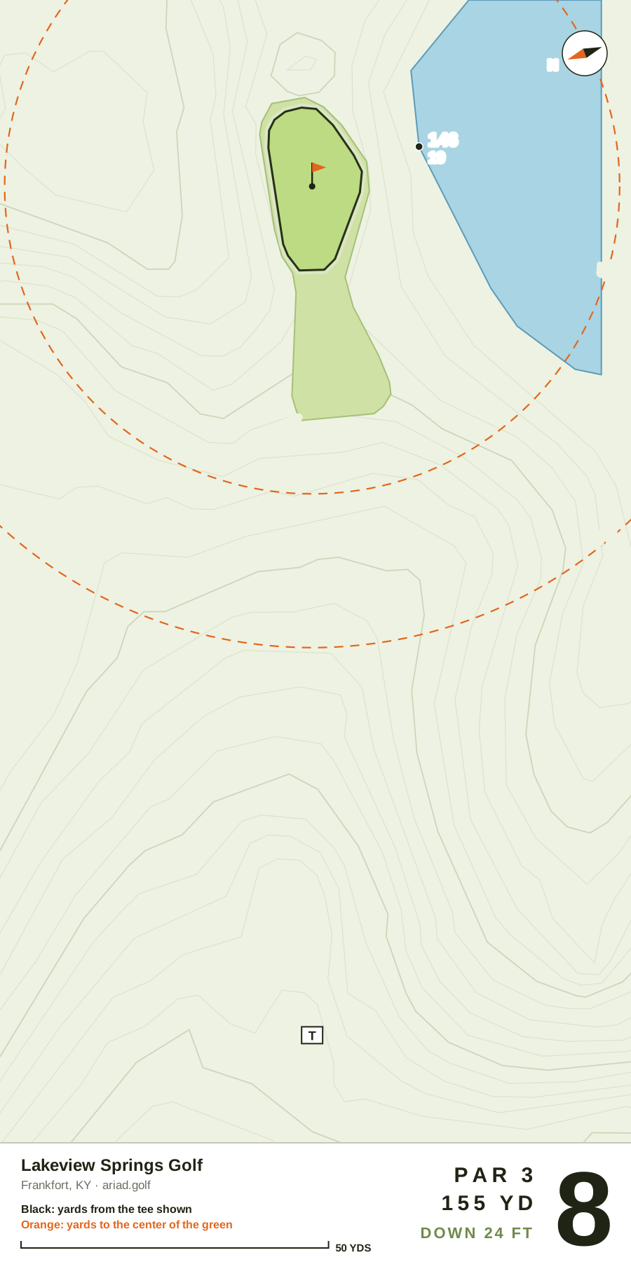
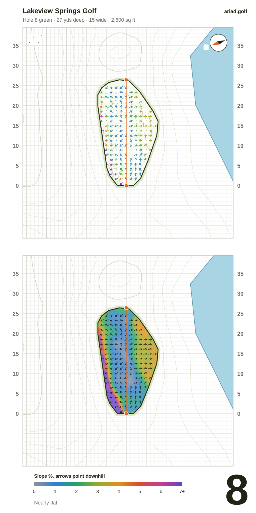
Par 3 · 155 yds (Red) · Handicap 1
- Green
- 27 yds deep, 15 wide · 2,600 sq ft
- Shape
- Straight
- Water
- Right of the green
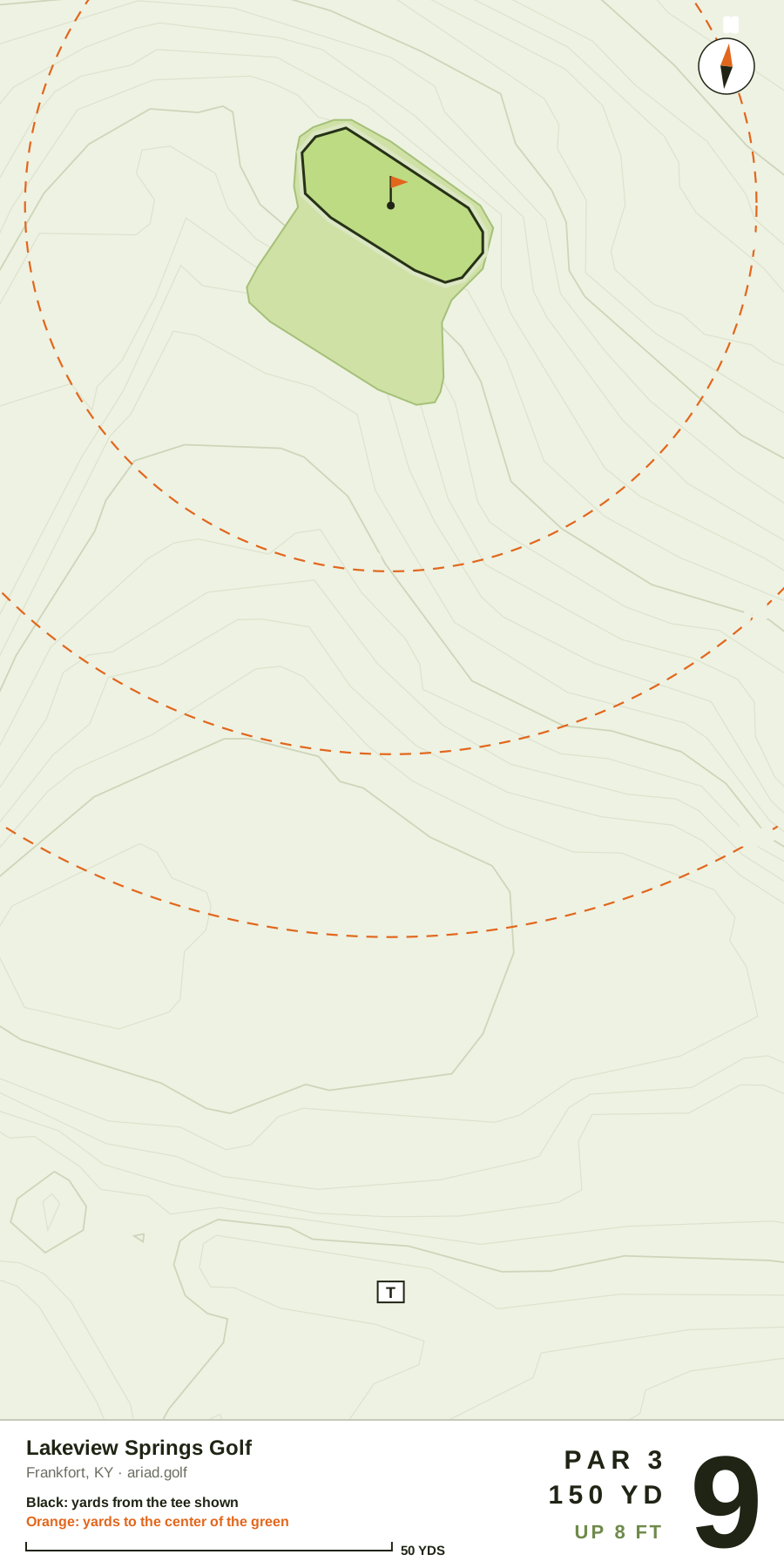
Par 3 · 150 yds (Red) · Handicap 7
- Green
- 21 yds deep, 25 wide · 2,600 sq ft
- Shape
- Straight
Black numbers are yards from the tee shown, orange numbers yards to the center of the green. Measured from aerial imagery and elevation surveys, so treat them as approximate.
Lakeview Springs Golf scorecard
View the published hole-by-hole scorecard, with par, tee yardages and handicap indexes where available. Choose your tees to plan your round.
- Total yards
- 1,483
- Par
- 29
- Course rating
- —
- Slope
- —
The round
| Hole | 1 | 2 | 3 | 4 | 5 | 6 | 7 | 8 | 9 | Total |
|---|---|---|---|---|---|---|---|---|---|---|
| Par | 4 | 3 | 3 | 4 | 3 | 3 | 3 | 3 | 3 | 29 |
| Yards | 225 | 170 | 145 | 230 | 100 | 170 | 138 | 155 | 150 | 1,483 |
| White Men | 213 | 164 | 126 | 209 | 88 | 150 | 128 | 129 | 132 | 1,339 |
| Handicap | 8 | 2 | 9 | 4 | 5 | 3 | 6 | 1 | 7 | — |
All distances in yards. Par and handicap reflect Red Women. A dash means we don’t have that value yet.
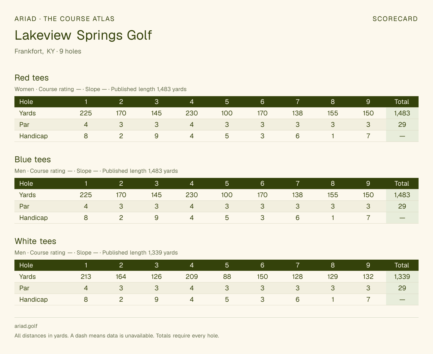 Save or print this scorecardOpen full-size image · All tees
3D FLY-THROUGH
Lakeview Springs Golf hole by hole
Explore Lakeview Springs Golf hole by hole on the 3D map, covering all 9 holes, with satellite views of mapped greens where available. Choose a mapped hole for a 3D fly-through and preview its layout before your round.
Hole 1Par 4225 yd
Drag to rotate · Right-drag to move · Scroll to zoom
About Lakeview Springs Golf
Lakeview Springs Golf is a municipal 9-hole, par-29 golf course in Frankfort, KY, opened in 1995. The free Lakeview Springs Golf yardage book shows all 9 hole layouts, with carries from the tee and distances to the center of each green. Lakeview Springs Golf green maps show the mapped putting surfaces for all 9 holes, with green dimensions where available. The greens average 2,800 sq ft, from 2,000 on the fifth to 3,300 on the sixth. Water comes into play on 1 hole. The layout has 7 par 3s and 2 par 4s. The number-one handicap hole is the 155-yard par-3 eighth. The longest hole is the 230-yard par-4 fourth.
Course information
- Location
- 112 Park Avenue, Frankfort, KY, 40601Get directions
- Course website
- Lakeview Springs Golf website
- Phone
- (502) 695-5870
- Opened
- 1995
COURSE QUESTIONS
Questions about Lakeview Springs Golf
Plan your round, from the first tee to the last green.
Is Lakeview Springs Golf public or private?
Lakeview Springs Golf is listed as a municipal golf course in Frankfort, KY.
How many holes and what par is Lakeview Springs Golf?
Lakeview Springs Golf is listed as a 9-hole course. The published scorecard totals par 29 for the Red tees.
How long is Lakeview Springs Golf?
Published tee lengths at Lakeview Springs Golf range from 1,339 yards (White) to 1,483 yards (Blue). Compare tee yardages.
Can I download a Lakeview Springs Golf course map PDF?
Yes. Download the free Lakeview Springs Golf course map PDF in Ariad’s watercolor illustration style, with numbered mapped holes, a north arrow and a yardage scale. The map preview shows the available hole coverage.
GET ARIADTake it to
Take it to
the first tee.
Ariad is golf GPS, shot tracking and 3D round replays for iPhone and Apple Watch, on the same course maps as this page.
Join the waitlist for launch updates. Screens from Ariad on iPhone and Apple Watch.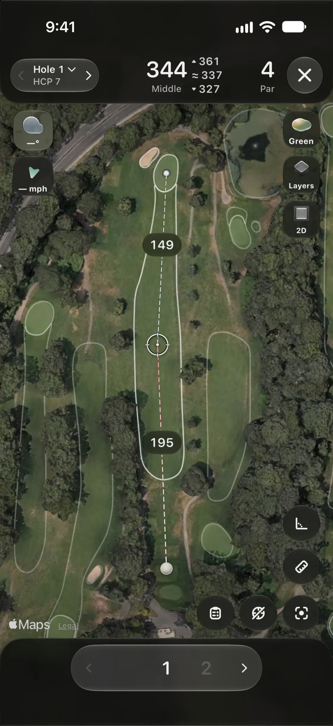 GPS
Every yardage, live.
Front, middle and back of the green, and the distance to any spot you tap, on a satellite map of the hole you’re playing.
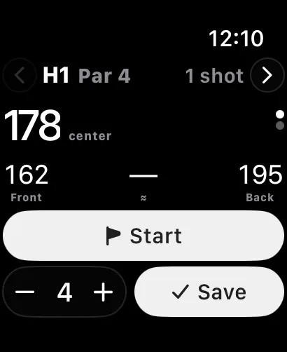 SHOT TRACKING
Mark it and walk on.
Tap where the ball finished and Ariad measures the shot. On Apple Watch it notices your swings, so the round keeps itself.
 3D REPLAYS
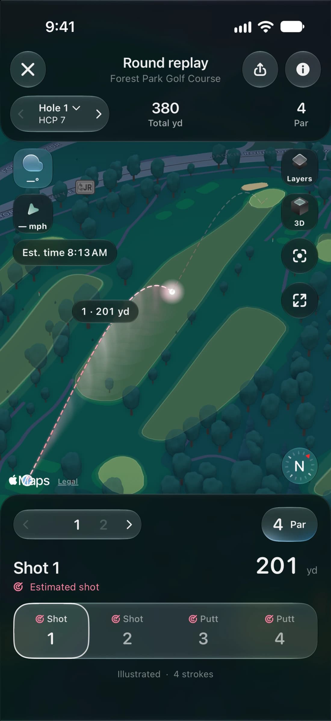
Fly the round back.
After the last putt, every hole comes back in 3D on real terrain, with each shot’s arc from the tee to the cup.